


Blaine Precinct, Kearney County, Nebraska
About
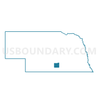
Outline

Summary
| Unique Area Identifier | 613309 |
| Name | Blaine Precinct |
| County | Kearney County |
| State | Nebraska |
| Area (square miles) | 54.45 |
| Land Area (square miles) | 54.43 |
| Water Area (square miles) | 0.02 |
| % of Land Area | 99.96 |
| % of Water Area | 0.04 |
| Latitude of the Internal Point | 40.59175480 |
| Longtitude of the Internal Point | -99.13197930 |
Maps


Graphs
Select a template below for downloading or customizing gragh for Blaine Precinct, Kearney County, Nebraska


Neighbors
Neighoring Voting District (by Name) Neighboring Voting District on the Map
- Anderson-Cottonwood Precinct, Phelps County, NE
- Center Precinct, Buffalo County, NE
- Collins Precinct, Buffalo County, NE
- Divide and Lake Precinct, Phelps County, NE
- Hayes/Logan/Sherman Precinct, Kearney County, NE
- Mirage Precinct, Kearney County, NE
- Newark Precinct, Kearney County, NE
Top 10 Neighboring County Subdivision (by Population) Neighboring County Subdivision on the Map
- Collins township, Buffalo County, NE (1,605)
- Hayes township, Kearney County, NE (1,481)
- Mirage township, Kearney County, NE (890)
- Center township, Buffalo County, NE (877)
- Blaine township, Kearney County, NE (612)
- Divide township, Phelps County, NE (344)
- Newark township, Kearney County, NE (198)
- Logan township, Kearney County, NE (160)
- Anderson township, Phelps County, NE (139)
- Cottonwood township, Phelps County, NE (96)
Top 10 Neighboring Unified School District (by Population) Neighboring Unified School District on the Map
- Kearney Public Schools, NE (36,232)
- Holdrege Public Schools, NE (6,994)
- Minden Public Schools, NE (4,397)
- Axtell Community Schools, NE (1,358)
Top 10 Neighboring State Legislative District Upper Chamber (by Population) Neighboring State Legislative District Upper Chamber on the Map
- State Senate District 37, NE (38,271)
- State Senate District 36, NE (37,224)
- State Senate District 38, NE (32,734)
Top 10 Neighboring 111th Congressional District (by Population) Neighboring 111th Congressional District on the Map
Top 10 Neighboring Census Tract (by Population) Neighboring Census Tract on the Map
- Census Tract 9697, Buffalo County, NE (5,956)
- Census Tract 9690, Buffalo County, NE (4,103)
- Census Tract 9666, Kearney County, NE (3,458)
- Census Tract 9672, Phelps County, NE (3,271)
Top 10 Neighboring 5-Digit ZIP Code Tabulation Area (by Population) Neighboring 5-Digit ZIP Code Tabulation Area on the Map
- 68845, NE (19,523)
- 68847, NE (16,504)
- 68959, NE (4,015)
- 68836, NE (1,688)
- 68924, NE (1,180)
- 68940, NE (496)